Are you looking for a method how to quickly, efficiently and accurately target and visualize your village, town, roads, tunnels, railway tracks or the banks of waterways?
Try our mobile mapping technology.
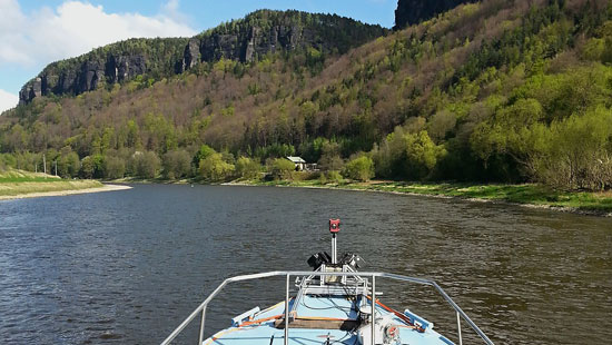
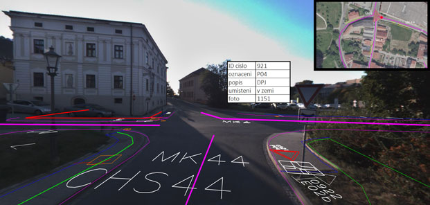
By mobile mapping we understand the unique technology to enable quick and efficient collection of geospatial data. All mobile mapping solutions are designed to be able to document the real world around us in 3D on the computer. This method of its efficiency perfectly replaces the traditional methods of mapping and this mapping method can handle almost anything. First of all this primarily involves the mapping of roads with traffic signs and objects along the roads, such as buildings, elevated engineering networks, greenery, civil facilities, street mobiliary, as well as railways lines, including overhead lines, mapping of the banks along the waterways.
The fact that the data obtained by this method can be called as Geo-reference with great accuracy, opens up possibilities for further analysis, usable e.g. for the government, or engineering companies.
How does it work:
Our company owns a mobile mapping system developed by the German company IGI mbH. The SAM system (Static And Mobile) uses two high-speed scanners Faro Focus 3D 120 in combination with 360 ° panoramic camera LadyBug3 and maximally precise GNSS / IMU system. The system itself thus enables the assembly of ground laser scanners on the roof of a car and is ready for mobile mapping. With some exaggeration, could therefore be said that SAM mounted “wheels” to terrestrial scanners.
With its low weight (about 25 kg), the system can be installed on any mobile device. Compact scanners can be easily mounted to the system and start the measurement of the surface at speeds of up to two million pixels per second. Just as easily can be released and start scanning of the ground.
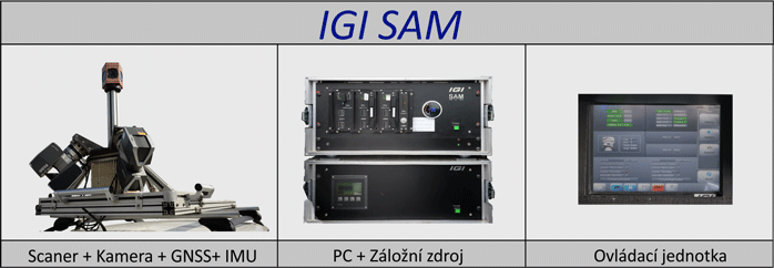
The added value of SAM system is an integrated GNSS / IMU system, including an end GPS and GLONASS receiver and precise Inertial Measurement Unit IMU.The accuracy of the data with aimed SAM meets the parameters necessary for project activity.
We offer:
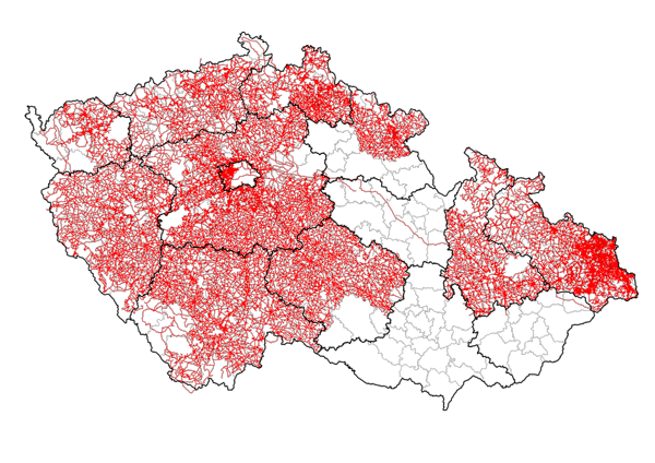
At this moment we own georeferenced panoramic images of 90,000 km of roads in the Czech Republic. See the map. These datas are ideal for your GIS.
Mapping and visualization of roads and objects along the roads:
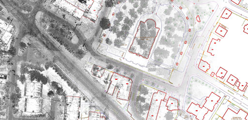
Passportisation of roads, traffic signs, street lighting, greenery, facilities etc .:
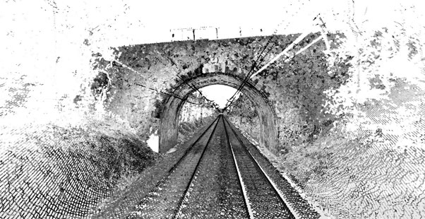
Mapping the railways, tunnels:
Mapping the banks of watercourses: